Palakkad

Hill station
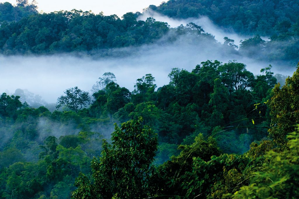
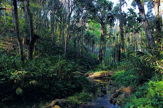
Nelliyampathy is a hill station within the Nelliyampathy Forest Reserve, in the southwest Indian state of Kerala. The road to it, which goes through the dense forests of the Western Ghats, is known for its many hairpin turns. To the west is Kesavan Para, a vantage point with views of nearby tea plantations. Farther west is the 19th-century Pothundi Dam. Northeast is the Seetharkundu Viewpoint, with waterfalls nearby.
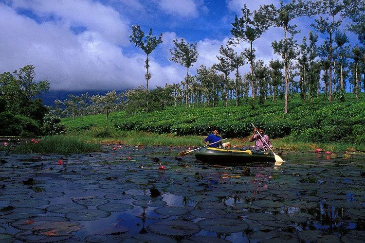
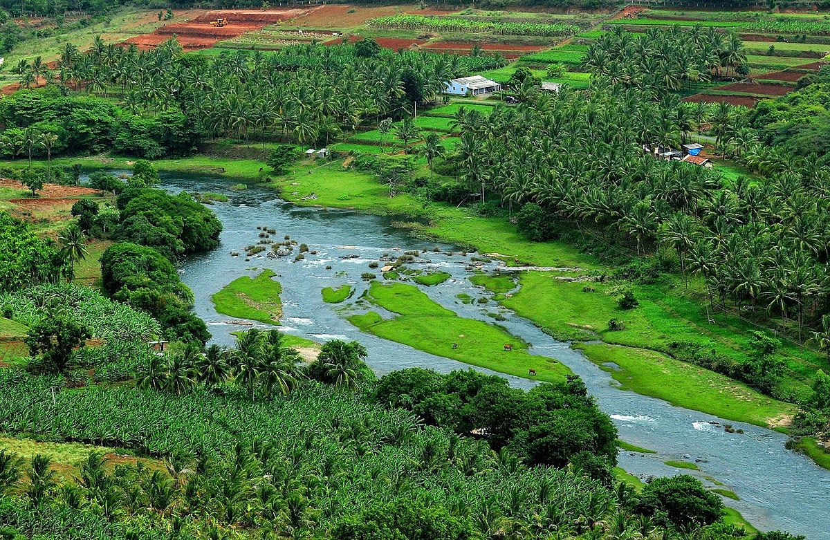
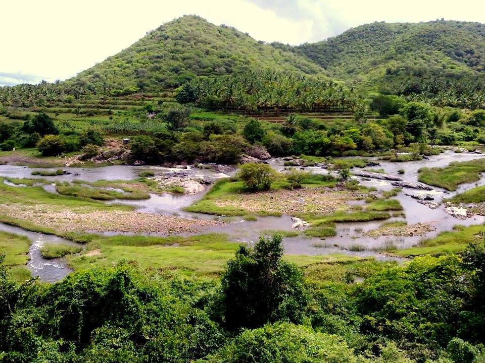
Nelliampathi is a popular hill station 60 km away from Palakkad in Kerala, a small state in south India. It is surrounded by tea and coffee plantations and has excellent weather conditions. The journey to Nelliampathi itself is an experience. The only route is from Nemmara, from where the first town of Nelliampathi, namely Kaikatty junction, is at a distance of 26 km. At the 9th kilometer is the Pothundi Dam, a small irrigation dam which provides water for the rice fields in the surrounding area.
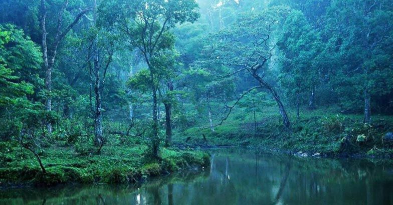
Pothundi dam is at the foot of the Nelliampathi hills. From here, the road winds up for the next 17 km, with many hairpin turns on the way. Immediately after Pothundy dam, comes the government forest, where one can see massive teak trees. On the way, one can see wild animals like monkey, deer and porcupine. The view of the Pothundy dam from the height is a breathtaking sight. There will be many waterfalls by the roadside during the rainy season. Nearest Airports are Cochin International Airport and Coimbatore Airport. Nearest main railway stations are Palakkad, Thrissur and Coimbatore.
At an elevation of 1000 metres at the southern tip of the Palakkad Gap, the Nelliampathi hills are known for their exquisite fauna. About 215 species of birds and 90 species of butterflies have been recorded in these hills. Some of the rare species of birds include Grey-breasted Laughing Thrush, Great Pied Hornbill, Jerdon's Baza, Great Black Woodpecker, Oriental Broad-billed Roller, Nilgiri Flycatcher, Broad-tailed Grassbird and Nilgiri Pipit. Primates including Lion-tailed Macaque, Bonnet Macaque and Nilgiri Langur are seen here. A small population of the endangered Nilgiri Tahr is also seen in the grassy peaks.
Tiger park
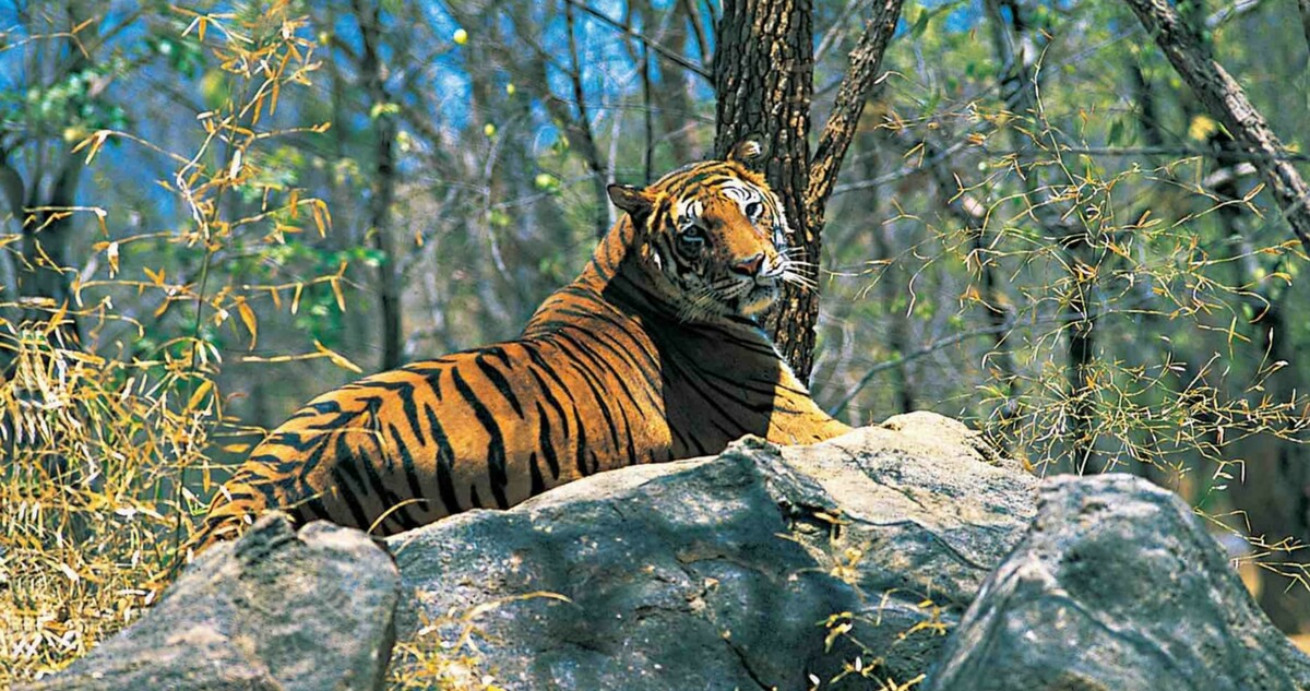
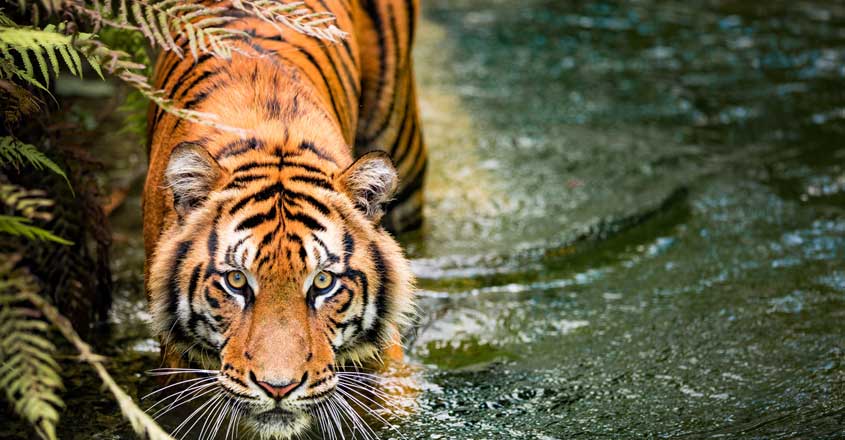
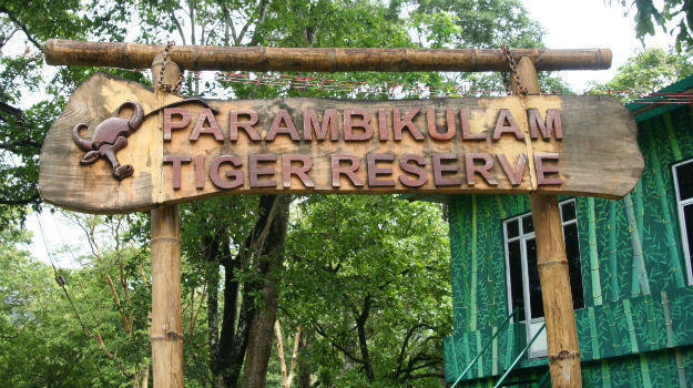
Parambikulam Tiger Reserve, which also includes the erstwhile Parambikulam Wildlife Sanctuary, is a 391 square kilometres (151.0 sq mi)[2] protected area in Kollengode Block, Chittur taluk in Palakkad district of Kerala state, South India. The wildlife sanctuary, which had an area of 285 square kilometres (110 sq mi) was established in 1973. It is in the Sungam range of hills between the Anaimalai Hills and Nelliampathy Hills.[3][4][5] Parambikulam Wildlife Sanctuary was declared as part of the Parambikulam Tiger Reserve on 19 February 2010.[6][7][8] Including the buffer zone, the tiger reserve has a span of 643.66 km2. The Western Ghats, Anamalai Sub-Cluster, including all of Parambikulam Wildlife Sanctuary, is under consideration by the UNESCO World Heritage Committee for selection as a World Heritage Site.[9] The sanctuary is the home of four different tribes of indigenous peoples including the Kadar, Malasar, Muduvar and Mala Malasar settled in six colonies. Parambikulam Tiger Reserve implements the Participatory Forest Management Scheme (PFMS). People from tribal colonies inside the reserve are engaged as guides for treks and safaris, and are provided employment through various eco-tourism initiatives.[10][11] The tiger reserve hosts many capacity building training programmes conducted by Parambikulam Tiger Conservation Foundation in association with various organisations.
The sanctuary is located between Longitude:76° 35’- 76° 50’ E, and Latitude:10° 20’ – 10° 26’ N. It is 135 kilometres (84 mi) from Palakkad town and adjacent to the Annamalai Wildlife Sanctuary to the east in Tamil Nadu. It is bordered to the north by Nemmara Forest Division, to the south by Vazhachal Forest Division and the west by Chalakudy Forest Division. The sanctuary has a hornblende, biotite, gneiss and charnockite geology.
Altitude ranges between 300 m and 1438 m. There is a 600 m elevation opening through the Nelliampathy hills from Anamalai hills on the northern boundary of the sanctuary at Thoothampara. Major peaks in the sanctuary are Karimala Gopuram (1438 m) in the southern boundary of the sanctuary, Pandaravarai (1290 m) in the north, Kuchimudi, Vengoli Malai (1120 m) in the eastern boundary and Puliyarapadam (1010 m) in the west.
The sanctuary has three man-made reservoirs; Parambikulam, Thunacadavu (Thunakkadavu) and Peruvaripallam, with a combined area of 20.66 km2. The Thuvaiar water falls empty into one of the reservoirs. There are 7 major valleys and 3 major rivers, the Parambikulam, the Sholayar and the Thekkedy. The Karappara river and Kuriarkutty river also drain the area.
one of the largest dam in Kerala
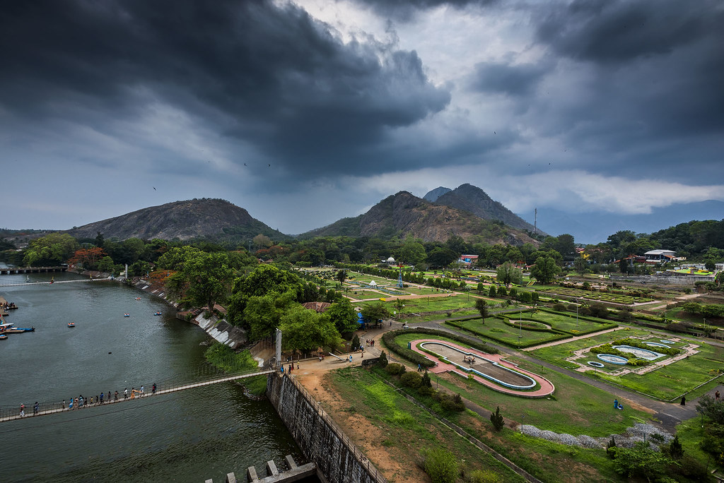
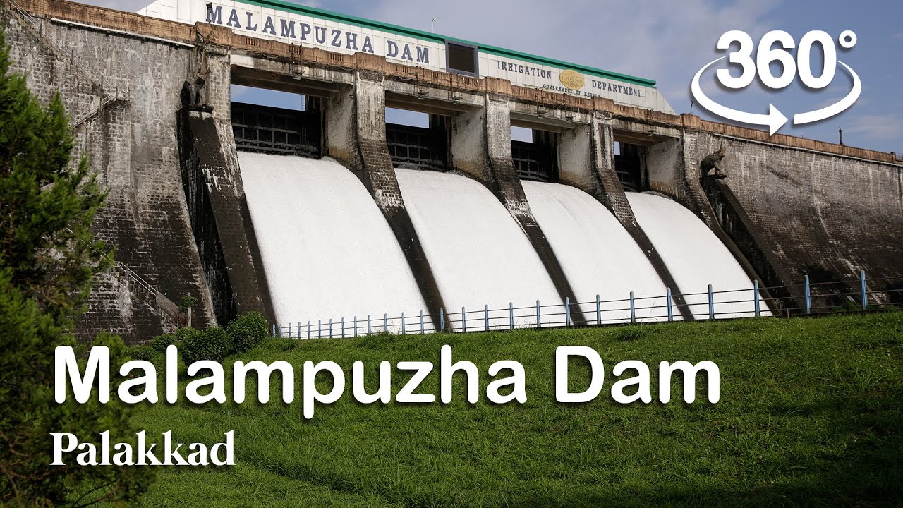
Malampuzha Dam is one of the largest dams and reservoirs in Kerala,[2] located near Palakkad, in the state of Kerala in South India, built post independence by the then Madras state. Situated in the scenic hills of the Western Ghats in the background it is a combination of a masonry dam with a length of 1,849 metres and an earthen dam with a length of 220 metres making it the longest dam in the state.[3] The dam is 355 feet high and crosses the Malampuzha River, a tributary of Bharathappuzha, Kerala's second longest river. There is a network of two canal systems that serve the dam's reservoir of 42,090 hectares.
The dam project was begun in 1949 and completed in 1955. foundation stone for the project was laid on 27 March 1949, by the then Public Works Minister of Madras State, Sri M. Bhaktavatsalam as Palakkad was a part of the Madras Presidency during those times. The dam was constructed in record time, and on 9 October 1955, the then Chief Minister of Madras State, Sri. K Kamaraj, inaugurated the dam. The total catchment area is 145 square kilometres, while the reservoir has a capacity of 8000 cubic meters of water. The canal systems serve to irrigate farmland while the reservoir provides drinking water to Paladin and surrounding villages.[4] The dam was constructed by the Madras government but upon the Creation of linguistically reorganized states ,The Malabar District encompassing the Dam became a part of the Kerala State.
Wildlife Sanctuary
Attappady (HQ:Agali) is a tribal taluk in Kerala state covering an area of 735 km². It is carved out from Mannarkkad taluk in Palakkad district on 2021.[1][2] Attappady Reserve Forest is a protected area comprising 249 km² of land area in the western parts of Attappady. It is one among the reserved forests and protected forests of India. Attappadi valley in Palakkad district along with the neighbouring Chaliyar valley of the Nilambur region (Eastern Eranad region) in Malappuram district, is known for natural Gold fields, which is also seen in the other regions of Nilgiri Biosphere Reserve.
Mannarkkad and Attappadi were parts of Valluvanad Swaroopam dynasty in medieval period with their headquarters at Angadipuram near Perinthalmanna in present-day Malappuram district. According to local legends, the last Cheraman Perumal ruler gave a vast extension of land in South Malabar during his journey to Mecca to one of their governors, Valluvakonathiri, and left for pilgrimage.[5] Valluvanad was famous for the Mamankam festivals at Tirunavaya, held once in 12 years and the endless wars against the Zamorin of Calicut.[5]
During the last decades of the eighteenth century, the region came under the control of the vast Kingdom of Mysore. Under British Raj, it was a part of Valluvanad Taluk of Malappuram Revenue Division in Malabar District. Perinthalmanna was the headquarters of the Old Walluvanad Taluk in the British Malabar District.[6] Mannarkkad, along with the towns of Perinthalmanna, Malappuram, Manjeri, and Tirurangadi, was one of the main centres of the Malabar Rebellion of 1921.[7]
Walluvanad Taluk was divided into six Revenue blocks: Mankada, Perinthalmanna, Mannarkkad, Ottapalam, Sreekrishnapuram, and Pattambi.[6][8] Walluvanad was one of the two Taluks included in the Malappuram Revenue Division (the other being Eranad Taluk) of British Malabar.[6] On 1st November 1957, the Walluvanad Taluk was divided into two: Perinthalmanna Taluk and Ottapalam Taluk.[8] The Revenue blocks of Mankada, Perinthalmanna, and Mannarkkad were included in the Perinthalmanna Taluk, while Ottapalam, Sreekrishnapuram, and Pattambi were transferred to the newly formed Ottapalam Taluk.[8] Later Attappadi Revenue block was separated from Mannarkkad Block.[9] During the formation of Malappuram district on 16th June 1969, the Revenue blocks of Mannarkkad and Attappadi were separated from Perinthalmanna Taluk to form Mannarkkad Taluk.[9]