Kozhikode

beach near Koyilandy
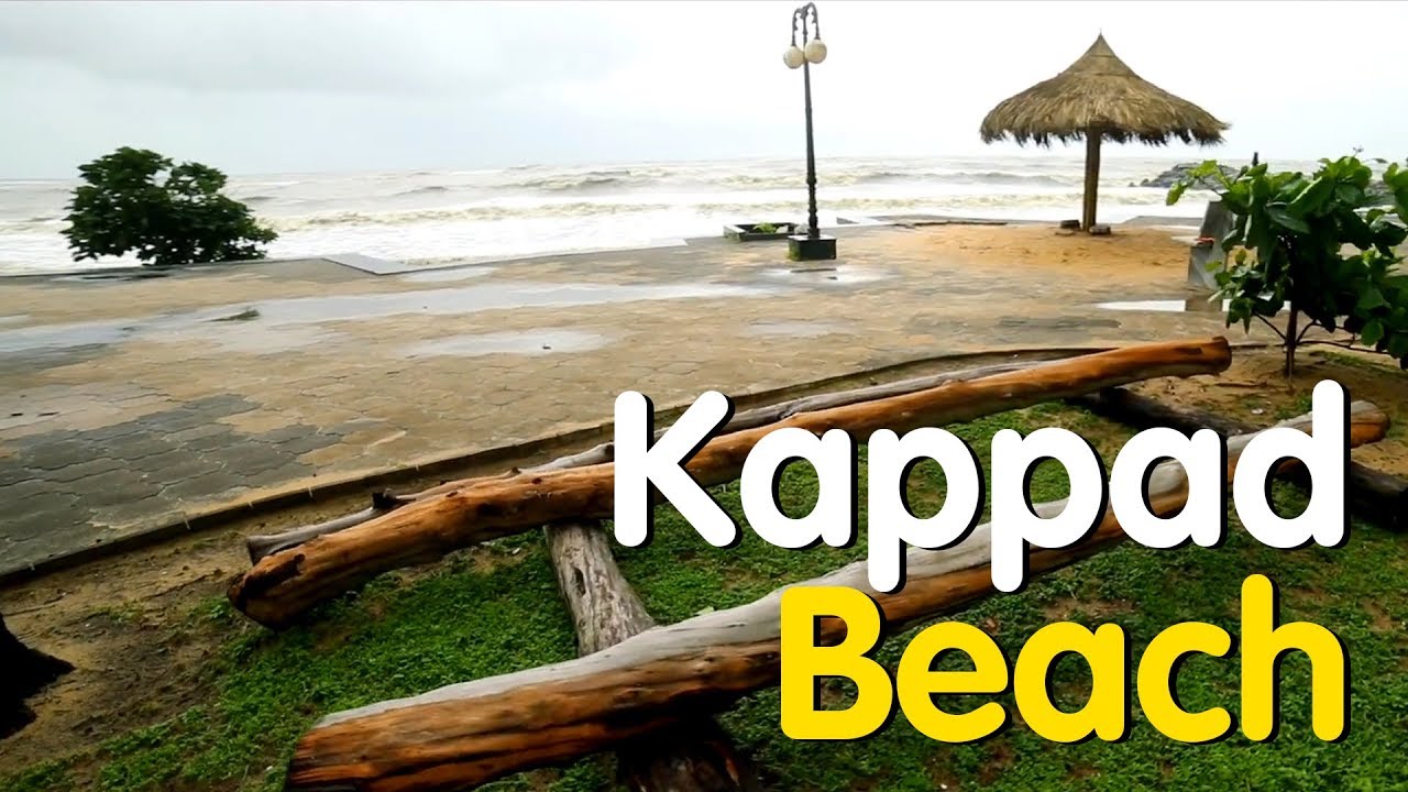
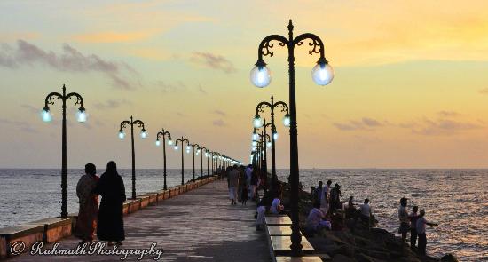
Kappad, or Kappakadavu locally, is a beach near Koyilandy, in the district Kozhikode, Kerala, India.
A stone monument installed by government commemorates the "landing" by Vasco da Gama with the inscription, 'Vasco da Gama landed here, Kappakadavu, in the year 1498'.
In 2007 a Rs. 1.5 crore program to beautify the beach was launched by [Kerala] Tourism Minister Kodiyeri Balakrishnan. It is now completed and Kappad beach has a corniche and park. The park includes a restroom, restaurant and seating.
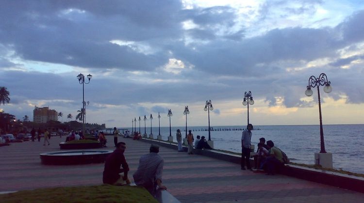
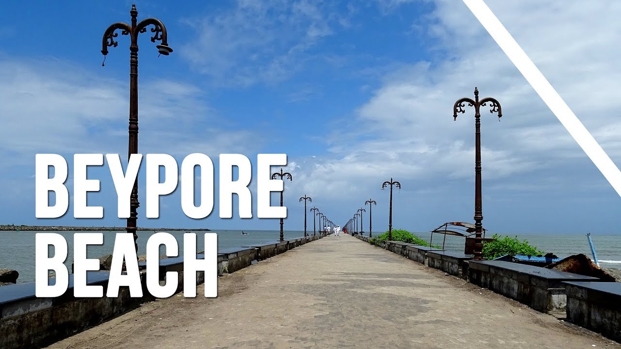
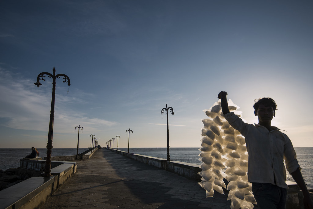
Beypur is an ancient port town
Beypore or Beypur is an ancient port town and a locality town in Kozhikode district in the state of Kerala, India. It is located opposite to Chaliyam, the estuary where the river Chaliyar empties into Arabian Sea. Beypore is part of Kozhikode Municipal Corporation. The place was formerly known as Vaypura / Vadaparappanad and also as Beydary. Tippu Sultan, ruler of Mysore, named the town "Sultan Pattanam". There is a marina and a beach while Beypore port is one of the oldest ports in Kerala, which historically traded with the Middle East. Beypore is noted for building wooden ships, known as dhows or urus in the Malayalam language. These ships were usually bought by Arab merchants for trading and fishing but are now used as tourist ships. According to Captain Iwata, founder member of the Association of Sumerian ships in Japan, Sumerian ships might have been built in Beypore. There is evidence to prove that Beypore had direct trade links with Mesopotamia and was a prominent link on the maritime silk route. The first railway line of Kerala was laid in 1861 from Tirur to Beypore (Chaliyam) passing through Tanur, Parappanangadi, Vallikkunnu, and Kadalundi.
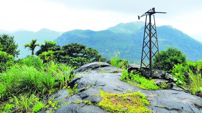
Ponmudi is a breathtaking hill station situated at the southern stretch of Western Ghats. Located within a short driving distance from Thiruvananthapuram, the capital of Kerala, Ponmudi literally means The Golden Peak.
The first thing that travellers to Ponmudi notice is the thick tropical forests that carpets the foot of the hill range. Hairpin bends, steep climb and mist covered stretches marks the route to Ponmudi from Kallar, located at the base of the village.
Located close to Agasthyar Hills, one of the biggest peaks in Western Ghats, Ponmudi offers excellent trekking and camping opportunities. Trekking through the thick forests one gets to see assortment of mountain flowers, unusual butterflies and small rivulets. However, the incline is steep and the trek rigorous.
For those who prefer casual strolls instead of trekking, Ponmudi would leave them impressed. A walk through the tea gardens is a feast for the eye and the senses.
n medieval period, Beypore was ruled by four Kovilakams - Karippa Puthiyakovilakam, Manayat Kovilakam, Nediyaal Kovilakam and Panagad Kovilakam. As the Gazetteers explain, the Beypore amsam itself had four Kovilakams called - Manayatt kovilakam, Nediyal kovilakom, Puthiya kovilakom and the Panangat kovilakom belonging to the family of the Beypore branch of the Parappanad family. Parappanad royal family is a cousin dynasty of the more famous Travancore royal family. Marthanda Varma, the founder of Travancore, belongs to Parappanad royal family. They also had branches at Parappanangadi, Vallikkunnu and Beypore.[15] So we have North and South Parappanad factions to start with, branching off the Parappur lordship. The North faction was further split into Beypore, Cheruvannor and Panniyankara Kovilakoms. Considering that Ravi Varma and his brother mentioned Beypore and the specific Manayyat location, let us for a moment assume Raja Ravi Varma hailed from the forerunners of the present Manayyat kovilakom.
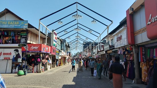
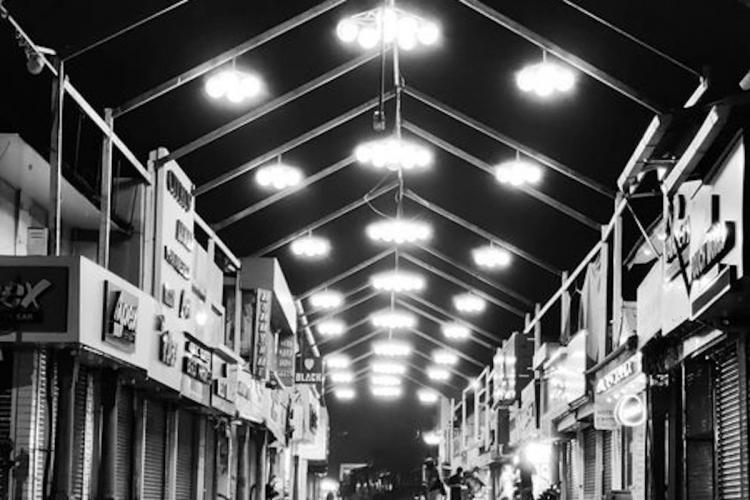
Muttayi theruvu
S.M. Street, abbreviation for Sweetmeat Street, also known as Mittai Theruvu, is a shopping street located in Kozhikode, Kerala, India. The street is a pedestrian zone. It also has a 160 year old Fire temple amidst shopping places.
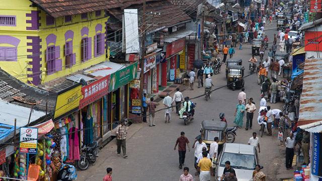
The history of SM Street dates back to time of the Zamorin when the ruler invited Gujarati sweetmeat makers to set up shop in the city and accommodated their shops just outside the palace walls.
From sweets to spices, clothes to electronics, or hand looms to textiles the shops at SM street offers everything which caters to your needs. Local handicrafts namely carvings made out of rosewood and buffalo horns, coir products such as floor mats, doormats, brushes, mattresses, and the snake boat toys, are the most popular ones.
In May 2017, As part of Phase 1 S.M. Street beautification project an amount of 3.64 crore was allocated. As part of renovation overhead power supply lines was removed and lamp posts was placed across the sides of street. Chief Minister Pinarayi Vijayan formally opened the renovated S.M. Street in Kozhikode on Saturday, 23 December 2017
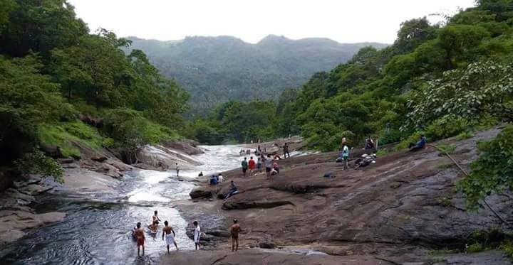
Kozhippara waterfalls
Kakkadampoyil, is a small village shared by Koodaranhi Panchayat of Kozhikode district and Malappuram district in Kerala, India. The village has recently emerged as a major tourist destination in the district.
Kakkadampoyil is situated in koodaranhi Panchayat in kozhikode District near Nilambur. This hilltop village is one of the coolest tourist destinations in Malabar region. It is about 15 km from Koodaranhi, 19 km from Thiruvambady and 24 km from Nilambur. Calicut city is about 50 km from here. There are many indigenous tribal groups in this area. It is set high on the Western Ghats, with altitudes ranging from 700 ft to 2100 ft. Kozhippara waterfalls are situated nearby here. KSRTC Buses are running services from Calicut and have few buses from Thiruvambady and Nilambur towns. There is also a continuous Jeep service from Koodaranhi town to Kakkadampoyil.
A large number of tourists come to Kakkadampoyil to enjoy the cool climate and to stay away from the bustle of the city.
On the mountain ranges of the Western Ghats bordering Kerala. Kakkadampoyil village, an unexplored hill station 48 km away from Calicut &NILAMBURCity. Surrounded by forests, misty hill ranges, deserted roads, untouched waterfalls (Kozhippara waterfalls), make the village worth a visit. Facilities for tourists are available.
Kakkadampoyil stands on the Western top of the Western Ghats with dense forest, and deep valleys. It is 24 km from Nilambur. The Cherupuzha (Malayalam: ചെറുപുഴ) is one of the important tributaries of Chaliyar River (:ചാലിയാര്).
griculture is the mainstay of the economy. Arecanut (Malayalam:അടക്ക), coffee (Malayalam:കാപ്പി), cocoa bean (Malayalam:കൊക്കോ), black pepper (Malayalam:കുരുമുളക് ), plantain (Malayalam:ഏത്തപ്പഴം ), vanilla (Malayalam:വാനില ) and coconuts (Malayalam:തേങ്ങ) are the main crops. Poultry farms are the new trend. Death percentage of chickens are very low. So so many farms are started recently.
In 2017 December, the Pinarayi Vijayan government decided to accord clearance to an 11 MW hydroelectric project in Kakkadampoyil. It will be the largest among the 20 small hydroelectric projects given clearance as part of the government’s move to shift focus to micro level projects in the face of public resistance against large projects.